
Palm Tree Previous Residents by Era
The backward trail begins with the record type that covers the period in question. A current assessment record identifies the parcel as it is presently described. A deed connects a grantor and grantee on a recorded date. Older indexes, atlases, directories, and census material add earlier names and household context. None of those sources alone proves every person who lived at an address. Together, they make it possible to distinguish a current owner, an earlier owner, a directory listing, and a census household without collapsing them into the same claim.
Orange County’s record history is especially layered here. Modern land records are online from late 1953 forward, while the historical route changes to index books, Record Room material, and FamilySearch images. Palm Tree became a town in 2019, so older material will often be filed under Monroe or Kiryas Joel. Start with the address and tax map in the present, then let the source date determine which historical label and access route to use.
| Trail source | Coverage period | Where held | What it can show |
|---|---|---|---|
| Palm Tree assessment roll and parcel data | Current data; 2025 final roll is a published example | Orange County and Town assessment sources | Current owner, mailing address, situs, tax map, value, and legal-description fields. |
| Palm Tree BAS tax search | Current collection; pre-2019 route points to Monroe | Palm Tree BAS | Bill, tax map, property address, owner, and payment or tax-status information. |
| IQS land records | December 31, 1953 to present, with back-scanning | SearchIQS and County Clerk | Deeds, mortgages, powers of attorney, and related land instruments. |
| County Clerk index and deed books | Grantor/grantee 1910-1977; deed books December 1947 to January 1978 | County Clerk historical access and Record Room | Names, record placement, historical deeds, and a bridge across the online cutoff. |
| FamilySearch Orange County deeds | 1703-1900, deed books A-450 and index material | FamilySearch and original County Clerk records | Historic parties, legal descriptions, witnesses, and transaction terms. |
| Regional directories and census books | Directories: 1899-1956 in incomplete regional runs; county census books: 1825-1875 | OCGS Research Room and County Clerk Record Room | Address, household, occupation, and enumeration context when available. |
| Federal census and historical atlases | Federal census 1790-1950; atlases 1875 and 1903 | NARA, library databases, FamilySearch, County Clerk historical sources | Household snapshot, land labels, roads, farms, and geography for the period. |
Note: Date every entry in the trail, because a tax roll, deed, directory, and census record each describe a different point in time.
Palm Tree Parcel Cards Start the Trail
Before searching an old name, freeze the current parcel details. Orange County’s Parcel Information search accepts owner name, address, tax-map number, and municipality. Save the property location, current owner field, owner mailing address, tax map, parcel class, legal description, subdivision or map number, and any prior deed book or page. The location of the land is the situs. The owner mailing line is a correspondence field. They may match, but the record does not say they always do.
The 2025 assessment-roll schema illustrates why those labels matter. Its rows separately carry property location, current owner, current owner address, tax description, school district, exemption columns, dimensions or grid data, special districts, and full-market-value fields. A unit number or a subdivision reference may be the only stable bridge between a present address and a deed that uses a different street form. Preserve every character in a tax-map number such as 305-1-22 or 302-3-2.3.
For an address that returns more than one possible match, use Orange County GIS to confirm the parcel point before moving to deeds. GIS can search owner, street address, or parcel ID and can limit the search to selected municipalities or the visible map area. It is a geography tool, not proof of title. The deed and the County Clerk’s records remain the sources for the recorded transfer.
Palm Tree Previous Residents Through Deeds
Deeds supply the ownership backbone for Palm Tree previous residents research, but the index is organized around people and instruments rather than a modern street address. Use the current tax map and legal description to bridge from the parcel search to the County Clerk index. The latest deed identifies the grantee who acquired the property and the grantor who transferred it. Its legal description, map reference, recording date, book and page or document number, and party names become the next checks.
- Find the current parcel and note the current owner, situs, tax map, legal description, and any previous deed reference.
- In IQS, search the current owner as grantee around the likely acquisition period, then retrieve or request the deed.
- Record the seller or grantor, the exact legal-description wording, the recorded date, and the book/page or document number.
- Search that seller as a prior grantee, matching the town or village label, lot or map reference, and approximate date before accepting the earlier instrument.
- Repeat each verified transfer backward. When the online path stops, use the historical index books, the Record Room, or FamilySearch as the appropriate era requires.
- Grantor
- The party who transfers an interest in a recorded deed. In a sale, this is usually the seller.
- Grantee
- The party receiving the interest. A current owner’s acquisition deed normally lists that owner as grantee.
- Chain of title
- The dated sequence of recorded transfers tied to the same land. It is built from verified instruments, not from a street name alone.
- Legal description
- The land description in the instrument, often using lot, map, section, block, or boundary language. It can remain stable when an address changes.
A mortgage satisfaction shows that a debt instrument was released. It does not, by itself, show a change in ownership. Likewise, a map filing can establish a lot layout without identifying a later occupant. Keeping those roles separate is essential when tracing who lived here before.
Palm Tree Deed Research Across Eras
The County Clerk’s Online Records page explains the modern gateway, the Record Room, and the difference between online access and counter research. It is the appropriate starting point when a Palm Tree prior-residents trail reaches a recorded land document.
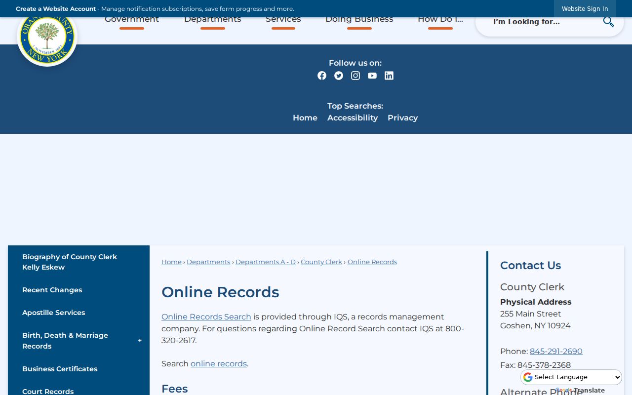
The online-records view reinforces that the land index is only one access channel. The County Clerk Record Room has free public computers and handles plain and certified copies. A mail copy request can name the document type, book/page, parties, property address, additional details, quantity, and whether a plain or certified copy is wanted. Include payment and a self-addressed stamped envelope when the clerk’s form requires it.
The SearchIQS availability sheet gives the actual coverage break: modern land records begin December 31, 1953, grantor/grantee index books run 1910-1977, and certain historical deed books cover December 24, 1947 through January 5, 1978. For earlier material, FamilySearch provides Orange County deed books A-450 and index material from 1703-1900, though the County Clerk remains the custodian. Historical-only IQS access is free, while modern image access uses subscription tiers; the Record Room and historical images answer different parts of the same question.
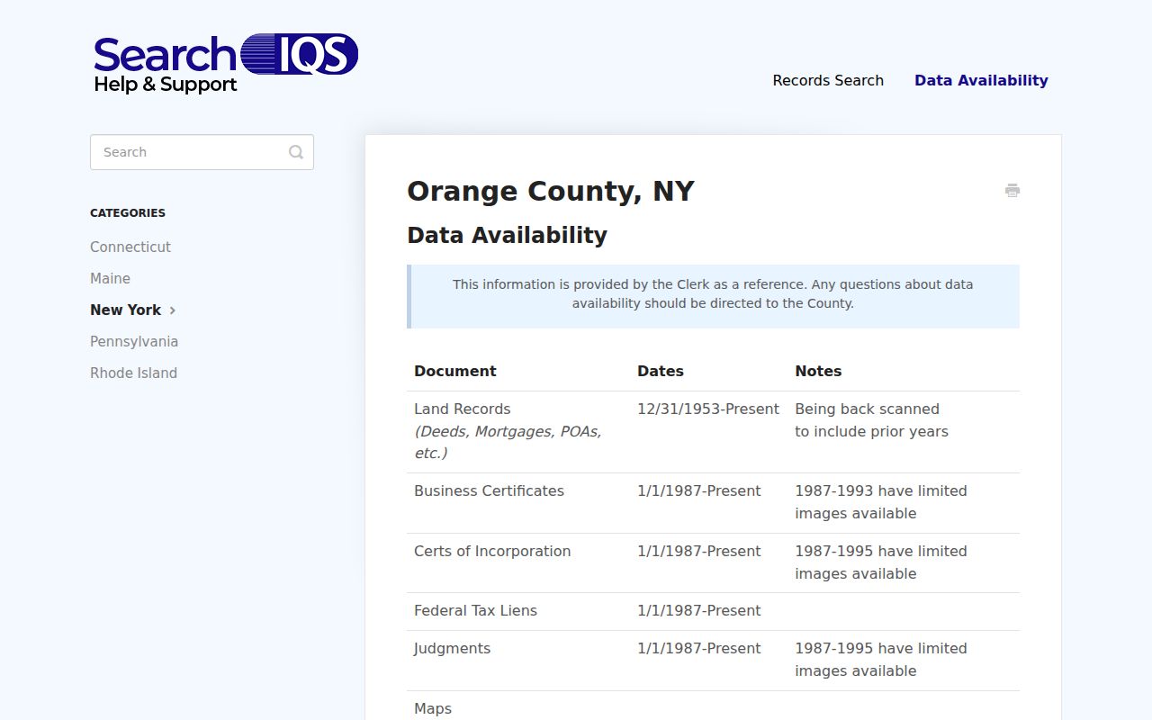
Use the coverage display as an era map, not as a promise that every image is online. If a book or index entry is not available in the web route, ask the Record Room to help locate the record. Confirm current access and copy fees with the County Clerk before relying on a price or end date.
Palm Tree Records Still Say Monroe
Palm Tree became New York’s newest town on January 1, 2019, created from former Town of Monroe territory and coterminous with the Village of Kiryas Joel. The land history did not begin that day. A present parcel can be Palm Tree/Kiryas Joel while its older deed, directory, census entry, newspaper notice, or local record says Monroe. Search the earlier labels alongside Palm Tree, then use the tax map and legal description to show that the references point to the same land.
Keep the original jurisdiction wording in a research log. “Town of Monroe” should not be silently rewritten as Palm Tree, and a Monroe postal city line should not be treated as proof that the parcel is in the Town of Monroe. The 2019 break is a useful historical clue because it tells the searcher which municipal label to try, rather than a reason to discard a well-matched older source.
Palm Tree Past Residents in Directories
Deeds show recorded owners, not necessarily every household. For the people layer, start with the former jurisdiction and use the Orange County Genealogical Society’s regional directory holdings. The documented runs are incomplete: Middletown and Port Jervis directories span 1899-1952, and Newburgh-area directories span 1899-1956. They are regional resources, not Palm Tree directory runs. Ask whether a volume has a street or criss-cross section, because that address-order portion can be more helpful than an alphabetical name list.
Read a directory entry as an annual snapshot. It can carry a name, residence, occupation, business or employer, and sometimes spouse, widow, or owner/renter notation. Check the printed abbreviation key in the specific volume before interpreting it. A business address is not automatically a residence, and an absent name may reflect a move, death, an annual gap, a variant spelling, or a choice by the publisher. The collection details belong with the Palm Tree city directory; the task here is to fit a confirmed entry into one address trail.
- Choose the directory year and search under Monroe, Kiryas Joel, Orange County, and the person’s exact historical spelling as needed.
- Record the title, year, page, spelling, address, and any spouse, business, or abbreviation detail shown in the volume.
- Use the street or criss-cross section if it survives, then compare the address with the parcel description instead of assuming an old street name is unchanged.
- Pair that annual entry with the nearest available federal or New York census year, noting that the census is a household snapshot on its enumeration date.
- Use a deed, tax record, obituary, or probate file as another dated identity check before treating the name as part of the address history.
Palm Tree Previous Residents in Census
Orange County’s own census books are an important offline layer. The County Clerk identifies books covering 1825-1875, and says they are not yet online, so the fallback is the Record Room rather than a missing web search. Federal census records run from 1790 through 1950 under the 72-year release rule. They add household members, ages, relationships, occupations, and residence at the enumeration date, but their geography can differ from later town lines and modern addresses.
County atlases from 1875 and 1903 help when the tract predates a modern parcel number or street address. They can place roads, farms, property labels, and period geography. They are not occupant directories. Pair an atlas with a deed or census item, then state clearly which fact comes from which source. The county’s historical holdings also include naturalization material, early tax records, and 1727-1779 Quarter Session minutes, useful only when their date and jurisdiction fit the specific person or property.
Note: The Palm Tree name is modern, so early census and atlas material must be searched and cited under its historical Monroe or Orange County geography.
Palm Tree House History Gaps
The official Orange County research page routes questions on family, cemetery, land, vital, naturalization, and local-history records to the appropriate county office or society. It is the best public starting point when a deed chain needs supporting records rather than a generic answer.
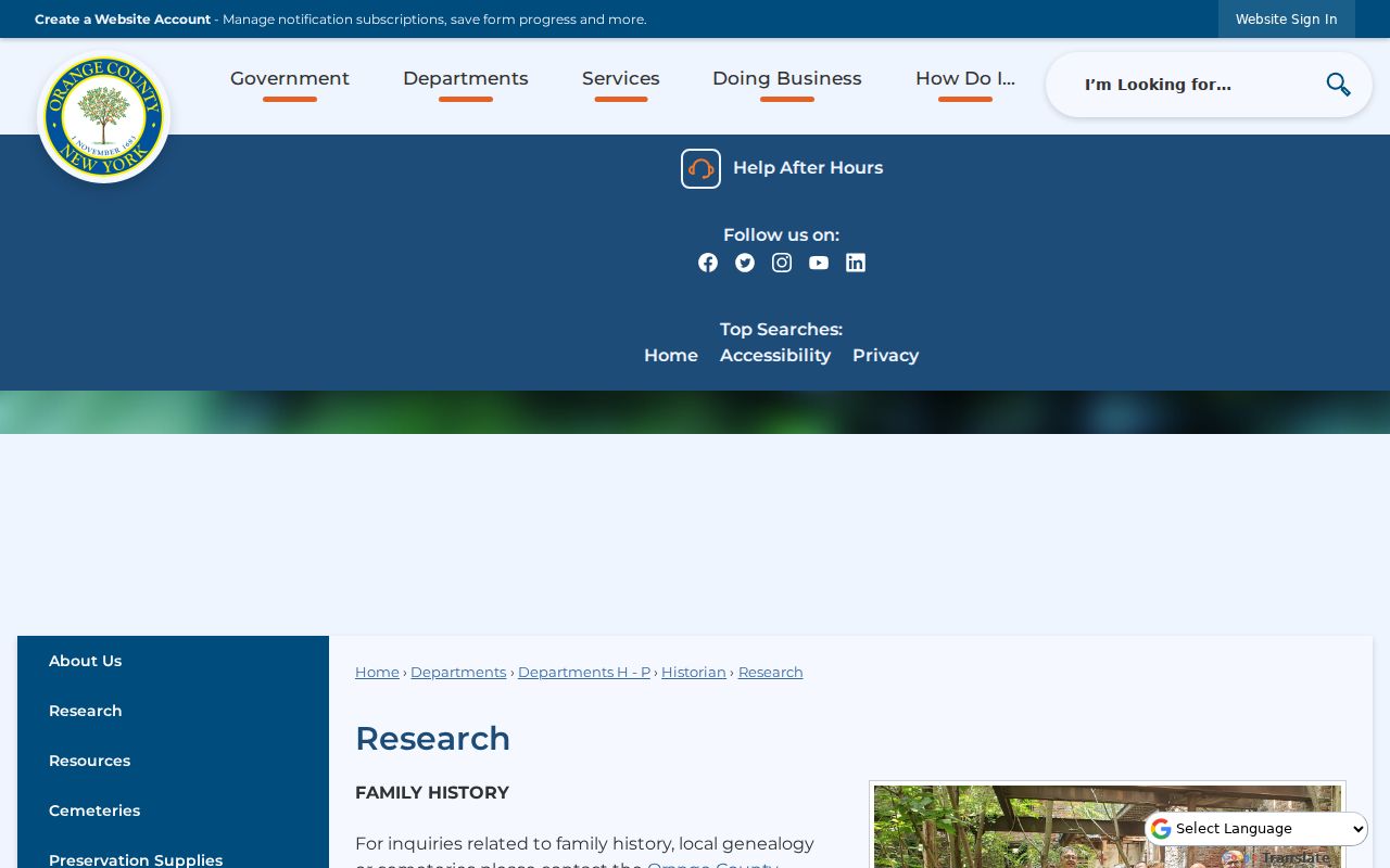
The page points back to the county’s archival and local-history network. OCGS has a research room at the 1841 Historic Courthouse in Goshen with microfilm and microfiche readers, a master surname index, county histories, local directories, and vertical files. Monroe Free Library also offers genealogy help. Neither source publishes a dedicated Palm Tree house-history guide or a complete Palm Tree directory shelf, so that gap should remain visible in the trail.
There is no verified official Sanborn map year list for Palm Tree/Kiryas Joel in the reviewed sources. Because the town began in 2019 and earlier history lies under Monroe, look for cataloged Sanborn material under Monroe, Orange County, and nearby villages before claiming a map covers the address. Similarly, permits, certificates of occupancy, planning files, code cases, sewer permits, and water records should be requested from the town or village clerk or building office with an exact address, tax map, record type, and date range. A permit can date a project or application; it does not prove a transfer or occupancy.
Palm Tree Previous Residents at Endpoints
Obituaries and probate can close or test an address trail after a person dies or leaves the property. A regional newspaper notice may identify relatives, former places, or a date. An Orange County Surrogate’s Court file can identify a decedent, executor, heirs, attorneys, and real-property references, subject to access rules and possible appointments or fees. Use the county research route for the regional newspaper and historical sources, then confirm a relationship or property claim against the probate file or recorded deed.
These are endpoint records, not shortcut resident lists. A death notice can identify relationships without proving that every relative lived at the address. A probate record can name an heir without proving a later title transfer. When an heir appears in a recorded deed, preserve the deed’s parties, date, legal description, and document number. That combination creates a careful historical connection rather than an inference from one name alone.
Palm Tree Previous Residents and Lawful Use
House-history research is strongest when it is specific and modest: record the source, the date, the role shown, and what remains uncertain. New York’s address protections and restricted records can make a missing name or location intentional. A parcel’s owner mailing address, an old directory line, or a record index is not a reason to assume a current personal location. Ask the custodian about a field or access limit when the record itself is unclear.
A good trail also preserves uncertainty. Mark each transfer as confirmed, probable, or unresolved. Keep a record’s exact town label, name spelling, unit number, and source citation. That makes a later correction possible and respects the difference between an ownership record, a household clue, and a verified historical fact.