
Find a Palm Tree Street Record
A Palm Tree street directory is an address-keyed research trail, not a list of every person on a road. The strongest first result is the parcel: it supplies the situs, current owner label, tax-map number, assessment fields, and map context. That parcel number can lead to recorded deeds and maps. A voter record, by contrast, is only an individual confirmation tool when a person’s name, date of birth, county, and ZIP are already known.
Keep the output precise. “Owner of record,” “owner mailing address,” “recorded party,” and “historical directory entry” describe different relationships. The county’s 2025 assessment roll shows why. A property location can be 3 Zenta Rd while the owner address carries a unit or another postal form. The two fields must remain separate when a Palm Tree street search is documented.
- Enter the address in Orange County Parcel Information, select Palm Tree if a municipality filter appears, and save the property location and tax-map number.
- Open the same address in OCGIS, inspect the parcel polygon and attributes, and note whether a Monroe or Kiryas Joel label appears alongside the Palm Tree result.
- Use the tax-map number, legal description, and current owner to locate the latest recorded deed through the County Clerk’s land-record route.
- Search the latest grantor as a prior grantee, matching the legal description and approximate recording period before moving back another step.
- For older address evidence, ask the Orange County Genealogical Society about regional criss-cross material under Monroe or Kiryas Joel.
Note: An assessment label can lag a recorded transfer, so compare the roll and the deed if the precise ownership date matters.
Palm Tree Street Directory Search Fields
Orange County’s address tools have distinct jobs. Parcel Information has the direct county search for owner name, address, tax map number, and municipality. OCGIS has the map-based parcel search and an address locator. OCGIS supports partial address text, owner name, parcel ID, municipality selection, and a viewable-area limit. It also accepts address, city, state, and ZIP in the locator, then uses Locate to zoom to a matched address or display potential matches.
| OCGIS field or control | Use for a Palm Tree street search | Result to retain |
|---|---|---|
| Street Address | Enter a full address or partial street text. | Candidate parcels and standardized map result. |
| Owner Name | Check a named owner against a parcel. | Parcel identity, not household membership. |
| Parcel ID | Reconnect the map to the assessment record. | Stable tax-map identifier. |
| Municipality | Limit results to Palm Tree or widen the context. | Jurisdiction used for the search. |
| Viewable Area | Browse a chosen map extent along a street. | Map date and visible parcel sequence. |
Use Search to run a query and Reset before a new one. More complete address text gives a more exact locator match. A partial string can find related street names, so check the parcel and municipality before deciding that a hit belongs to the intended Palm Tree street.
Palm Tree Address Labels Explained
The Palm Tree street directory needs three fields, not one: municipality, situs, and legal parcel. The municipality tells the local jurisdiction. The situs is the property location printed in an assessment record. The legal parcel is the tax-map or legal-description bridge used in deeds, maps, and older files. A Monroe postal city line does not erase a Palm Tree parcel, and a tax-roll owner address may be a correspondence address rather than the location of the land.
The county’s 2025 final roll uses identifiers such as 305-1-22, 302-3-2.3, and 306-1-17. It also preserves class, school district, exemptions, tax description, dimensions or grid information, special districts, and sometimes a deed book/page. In a dense municipality, a unit number, subdivision map name, or parcel suffix can distinguish results that would look alike if reduced to a street name alone.
- Parcel
- A tax-mapped unit of land with its own identifier.
- Situs address
- The property location shown by a parcel record.
- Plat or subdivision map
- A filed map showing lots, blocks, dimensions, or a subdivision layout.
- Criss-cross directory
- An address-arranged historical directory that may connect a street to a listed occupant.
Palm Tree Streets in OCGIS
OCGIS is useful for moving along a Palm Tree street without turning the search into a people list. Find the subject address, open the parcel attributes, capture the tax map, then zoom out one or two scales. Adjacent polygons, road segments, municipal boundaries, election districts, and other map layers can provide the geography needed to keep a street research log organized. Select individual parcels rather than assuming all visible property shares one ownership or history.
The county describes its map data as informational and provided as-is. It is not a legal survey. Save the map date and any potential-match screen, especially where an incomplete address produces more than one candidate. If a road reaches an adjoining municipality, change the municipality setting and label the returned jurisdiction separately.
The Orange County GIS map gallery provides the entry point for the parcel-viewer portion of a Palm Tree street directory search.
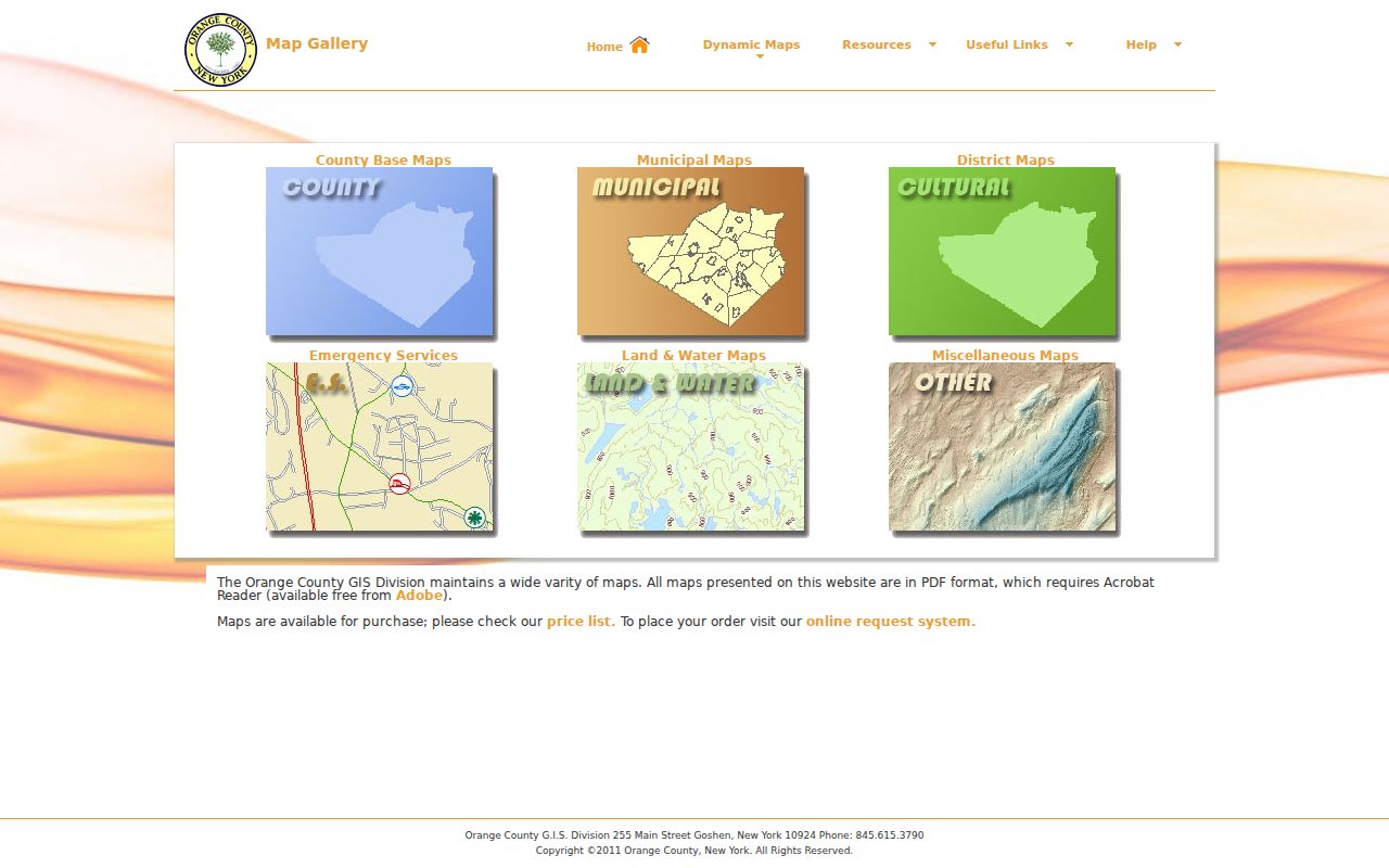
The map route helps connect an address to parcel geometry and county layers before a deed, tax, or historical source is compared.
Palm Tree Tax Searches by Address
The Palm Tree BAS tax portal adds bill and collection information to a street directory search. It accepts a collection choice, bill number, tax map number, property address, and owner name. The public page exposes the current 2026 Town and County bills and links to village, school, sewer, and water collections. It directs older tax work before 2019 to the Town of Monroe route, which is consistent with Palm Tree’s municipal history.
Use the BAS result to preserve the bill, parcel, owner field, property address, and tax status as printed. The town’s public page says unpaid taxes after April 1, 2026 go to the Orange County Commissioner of Finance and will not be reflected on the town site. That division makes a date check important. Tax records show parcel administration, not every current occupant or a conclusion about residency.
The Palm Tree BAS tax search displays the address, owner-name, bill, and tax-map entry fields used for the local current-collection check.
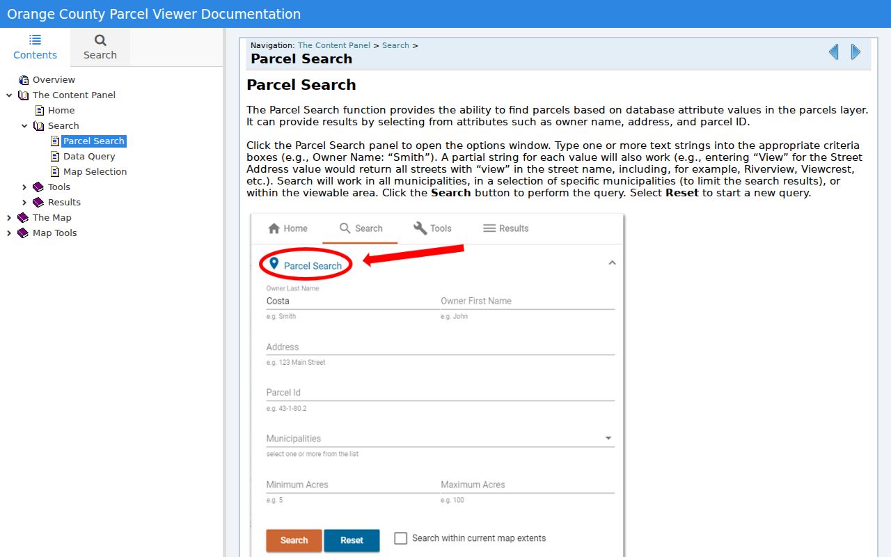
Save the collection year with any result, because an older Monroe tax record and a current Palm Tree bill can refer to the same local address under different municipal labels.
Palm Tree Street Directory Record Sources
The address-keyed Palm Tree street directory sources each answer a limited part of the question. Parcel and tax records identify the land and current roll fields. OCGIS shows where the parcel sits and which polygons are adjacent. The deed index reaches recorded parties and legal descriptions. A public voter lookup cannot be used to browse a street. Local permit and code files can be requested by address, but no official Palm Tree online permit index was located in the research.
| Address-keyed record | What it can show | Custodian and access |
|---|---|---|
| Parcel and assessment roll | Situs, owner field, mailing address, tax map, class, values, districts | Orange County Real Property, free online and county channels |
| Palm Tree BAS tax bill | Bill, parcel, owner, property address, payment or tax status | Palm Tree Receiver of Taxes, free current search |
| GIS parcel map | Parcel polygon, address point, adjacent parcels, public layers | OCGIS public viewer |
| Recorded deed and map index | Grantor, grantee, recording details, legal description, map trail | Orange County Clerk IQS and Record Room |
| Permit or code file | Application, work, inspection, certificate, or disposition if retained | Town or village clerk and building or code office request |
| Historic criss-cross source | Address-arranged historical entry when a volume has a street section | OCGS regional, incomplete in-person holdings |
The property record supplies the join between these systems. A street line is useful for starting the search, but the tax map and legal description are the stronger link when an older map, new unit, or changed municipal label makes the street text ambiguous.
Palm Tree Street Directory Deed Chain
The County Clerk’s land index is not an address database, so the Palm Tree street directory deed method starts with the parcel. Use the current owner as the likely grantee, retrieve or request the latest deed, identify the seller or grantor, and search that person as an earlier grantee. Match the town or village label, section-block-lot information, subdivision map, legal description, and recording period at every step. A mortgage satisfaction is a debt-release document, not proof that ownership changed.
IQS publishes modern land coverage beginning December 31, 1953, with historic grantor/grantee index books for 1910-1977 and deed books dated December 24, 1947 through January 5, 1978. The County Clerk historical resources identify Orange County deed and mortgage material from 1703 through 1900. The online access route, historical books, and in-person counter are complementary rather than interchangeable.
The Orange County Clerk Record Room has free public computers and is the fallback when an index points to a book, image, or copy that is not available in the web interface. For an address trail across the decades, use the Palm Tree past residents route after identifying the parcel.
Palm Tree, Kiryas Joel, or Monroe
The local naming pattern is a practical street-directory quirk. Palm Tree became official on January 1, 2019, and it is coterminous with the Village of Kiryas Joel. Pre-2019 deeds, directories, census entries, and town files are usually indexed under Monroe. A current record may show Palm Tree for the municipality and Monroe, NY 10950 for postal delivery. Neither label should be silently normalized away.
Run a historical street search under the original Monroe terminology, then cross-check the legal description and tax map against the current Palm Tree record. Preserve abbreviations, unit numbers, hyphenation, and wording from the official source. A printed “Schunnemunk Rd” and a standardized “Schunnemunk Road” may be the same location, but an unverified text change can hide a different parcel or an OCR error.
Note: No verified Palm Tree street-renumbering or townwide street-renaming project was located, so do not invent a numbering origin for local roads.
Palm Tree Street Directory Voter Limits
New York’s voter form is an individual match, not a Palm Tree street directory. The NYS Voter Lookup requires county, first name, last name, date of birth, and ZIP. Palm Tree searches use Orange County. A match can supply state-provided registration, poll-site, or ballot-tracker information, but it does not provide a street-wide roster and a non-match does not prove that a person is not connected to an address.
New York Election Law keeps sensitive registration details such as DMV or non-driver ID numbers, Social Security numbers, and signature facsimiles out of public release. A complete voter-file route has different rules and requires an elections-purpose statement for statewide-list information. OCGIS election district layers are helpful for civic geography, but a district polygon is not a list of people who live within it.
Palm Tree Address Record Requests
When a current Palm Tree street directory search reaches a source without an online index, ask the right custodian for an existing address-keyed record. For a permit, certificate, violation, site plan, planning file, sewer or water record, identify the full address, tax map, known applicant or owner, record type, and date range. Ask for the permit number, work description, filing date, inspection or disposition, and final certificate when those are retained. A permit can date work or approval, but it does not establish occupancy or a sale.
For Clerk-held records, a copy request can be narrowed by document type, party names, property address, book/page, and whether a plain or certified copy is needed. For a government record not otherwise available, New York’s FOIL guidance describes requests under Public Officers Law Article 6. A carefully defined request makes it easier for an office to find an existing record and apply required privacy review.
Palm Tree Street Directory Limits
A Palm Tree street directory cannot establish every occupant, household member, unlisted phone record, utility customer, delivery recipient, protected voter address, or a legal conclusion about who lives in a parcel. DMV personal information is also restricted. The accurate public labels are owner of record, owner mailing address, registered-voter match, recorded party, and historical directory entry. Each has a specific source and date.
New York’s Address Confidentiality Program can protect a participant’s physical location through a substitute address. Respect an unavailable or redacted field. Where the map, roll, and deed disagree, record the conflict and ask the relevant custodian which field is current rather than forcing a street-level conclusion.